
Sudan address generator
Random Sudan addresses with real district and province names, laid out the way Sudan writes them. No open dataset links postcodes to places. Postcodes are left out unless you turn on pattern-valid placeholders.
- B Places verified
- 112 districts
- 18 provinces
- Postcode: not linked
- Arabic + Latin

Options
شارع السوق، مبنى 109، شقة 28 بحري السودان
- District and province: GeoNames; postcode: not linked to places
- Street name, number: synthetic
Synthetic test data: not a verified or deliverable address.
- Street
- شارع السوق، مبنى 109، شقة 28 Building 109, Al Souq Street, Apt 28
- City
- بحري Khartoum North
- Province
- الخرطوم Khartoum
- Postcode
- Not linked to placesNo open dataset links postcodes to places here. Turn on placeholder postcodes to add a pattern-valid one.
- Country
- Sudan (SD)
- Coordinates
- 15.649, 32.535 Approximate centre of the locality, not the building
How addresses are written in Sudan
Layout from Google’s address metadata (libaddressinput), the format data Chrome and Android use for address forms.
- Required fields
- Street address and district
- Postcode
- Examples:
11042,11113
Pattern:\d{5} - Provinces
- 18 in the dataset
- Script
- Arabic, with a Latin-script version for international use
- Calling code
- +249
About the data for Sudan
BPlaces verified. Places and regions are dataset-backed, but no open dataset links postcodes to places, so postcodes are left out unless you ask for placeholders.
- Localities
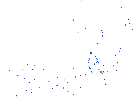
- 112 · GeoNames populated places (cities500)
- Postcodes
- No open dataset links postcodes to places. Postcodes are left out unless you turn on pattern-valid placeholders.
- Names
- Arabic (Gulf and Levant) (regional approximation)
- Streets
- Synthetic names built from common local street words. They are not taken from real maps.
- Local-script names are available for 43% of places; the others are shown in Latin script only.
Sample Sudan addresses
Eight addresses generated with a fixed seed. The district, province are real; street names and numbers are not.
| Formatted address | Latin script | Postcode |
|---|---|---|
| شارع الربيع، مبنى 66، الطابق 10، شقة 32 الأبي | Building 66, Al Rabie Street, Floor 10, Apt 32 El Obeid | — |
| شارع ابن خلدون، مبنى 17 الدمازين | Building 17, Ibn Khaldun Street Ad-Damazin | — |
| شارع الملك عبدالعزيز، مبنى 148 الضعين | Building 148, King Abdulaziz Street El Daein | — |
| جادة البحر، مبنى 590، الطابق 10، شقة 19 Burām | Building 590, Al Bahr Avenue, Floor 10, Apt 19 Burām | — |
| جادة الأمير سلطان، مبنى 630 سنار | Building 630, Prince Sultan Avenue Sennar | — |
| شارع الزهور، مبنى 8 أم درمان | Building 8, Al Zuhur Street Omdurman | — |
| شارع البحر، مبنى 3، مكتب 14 أم درمان | Building 3, Al Bahr Street, Office 14 Omdurman | — |
| جادة المدينة، مبنى 47 ربك | Building 47, Al Madina Avenue Rabak | — |
Provinces of Sudan
Pick one in the generator above to keep every address inside it.
| Province | Local name | Localities |
|---|---|---|
| Al Jazirah | ولاية الجزيرة | 10 |
| Al Qaḑārif | القضارف | 6 |
| Blue Nile | النيل الازرق | 4 |
| Central Darfur | ولاية وسط دارفور | 1 |
| Eastern Darfur | ولاية شرق دارفور | 2 |
| Kassala | كسلا | 4 |
| Khartoum | الخرطوم | 13 |
| North Kordofan | شمال كردفان | 4 |
| Northern Darfur | شمال دارفور | 5 |
| Northern State | الشمالية | 7 |
| Red Sea | ولاية البحر الاحمر | 6 |
| River Nile | ولاية نهر النيل | 6 |
| Sennar | سنار | 9 |
| Southern Darfur | جنوب دارفور | 7 |
| Southern Kordofan | جنوب كردفان | 5 |
| West Kordofan | غرب كردفان | 8 |
| Western Darfur | غرب دارفور | 3 |
| White Nile | النيل الأبيض | 12 |
 South Sudan
 Chad
 Egypt
 Ethiopia
 Eritrea
 Libya
 Central African Republic